
IMD issues heavy rain alert across states. What is Delhi weather for today?
The sudden surge arrives against the backdrop of a dry monsoon season. Nationally, cumulative rainfall from June 1 through mid-August sits at a 12% deficit compared to the Long Period Average (LPA).
- Aug 23, 2026,
- Updated Aug 23, 2026 5:00 AM IST
Dark clouds gathered over central and eastern India as two converging weather systems forced a fresh surge in monsoon activity, prompting forecasters to issue warnings for heavy to very heavy rainfall starting today.
The India Meteorological Department (IMD) confirmed that an active atmospheric system over northeast Madhya Pradesh, coupled with a low-pressure area forming off the West Bengal-Bangladesh coast, is driving the current deluge. The monsoon trough currently stretches from Amritsar down to the Bay of Bengal, dragging intense moisture across multiple regions.
Central and eastern states face the brunt of the onslaught. Isolated places in Chhattisgarh, East Madhya Pradesh, East Uttar Pradesh, and Odisha are on alert for exceptionally heavy downpours. Torrential rain is also set to pound the northeastern belt, including Assam, Meghalaya, Arunachal Pradesh, and Nagaland.
Across Northwest India, scattered to isolated heavy rainfall is expected in Himachal Pradesh, Uttarakhand, Punjab, Haryana, and West Uttar Pradesh. The national capital region and Delhi-NCR are likely to see scattered spells with isolated heavy downpours.
Along the western coastline, fairly widespread to moderate showers will continue across Konkan, Goa, Coastal Karnataka, and Kerala. Authorities have advised residents in low-lying areas to prepare for potential waterlogging and localized travel disruption.
The sudden surge arrives against the backdrop of a dry monsoon season. Nationally, cumulative rainfall from June 1 through mid-August sits at a 12% deficit compared to the Long Period Average (LPA). A severe 40% shortfall in June followed by a weaker second half has left major agricultural belts trailing, making this late August spell critical for kharif crop survival.
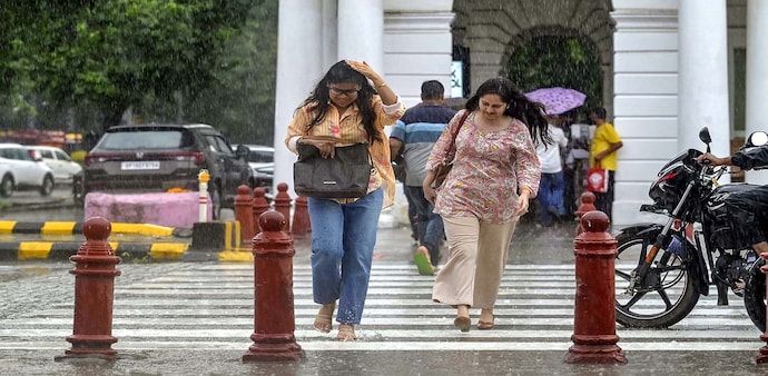
For local urban corridors like Ghaziabad and the broader Delhi-NCR, the IMD projects overcast skies with light to moderate rainfall spells throughout Sunday. While no severe flood warnings are active for the NCR, localised waterlogging is expected on low-lying stretches like the Delhi-Meerut Expressway, NH-9 underpasses, Indirapuram, and Sahibabad. Authorities advise commuters to monitor traffic advisories and avoid low-lying intersections during peak downpours.
Dark clouds gathered over central and eastern India as two converging weather systems forced a fresh surge in monsoon activity, prompting forecasters to issue warnings for heavy to very heavy rainfall starting today.
The India Meteorological Department (IMD) confirmed that an active atmospheric system over northeast Madhya Pradesh, coupled with a low-pressure area forming off the West Bengal-Bangladesh coast, is driving the current deluge. The monsoon trough currently stretches from Amritsar down to the Bay of Bengal, dragging intense moisture across multiple regions.
Central and eastern states face the brunt of the onslaught. Isolated places in Chhattisgarh, East Madhya Pradesh, East Uttar Pradesh, and Odisha are on alert for exceptionally heavy downpours. Torrential rain is also set to pound the northeastern belt, including Assam, Meghalaya, Arunachal Pradesh, and Nagaland.
Across Northwest India, scattered to isolated heavy rainfall is expected in Himachal Pradesh, Uttarakhand, Punjab, Haryana, and West Uttar Pradesh. The national capital region and Delhi-NCR are likely to see scattered spells with isolated heavy downpours.
Along the western coastline, fairly widespread to moderate showers will continue across Konkan, Goa, Coastal Karnataka, and Kerala. Authorities have advised residents in low-lying areas to prepare for potential waterlogging and localized travel disruption.
The sudden surge arrives against the backdrop of a dry monsoon season. Nationally, cumulative rainfall from June 1 through mid-August sits at a 12% deficit compared to the Long Period Average (LPA). A severe 40% shortfall in June followed by a weaker second half has left major agricultural belts trailing, making this late August spell critical for kharif crop survival.
For local urban corridors like Ghaziabad and the broader Delhi-NCR, the IMD projects overcast skies with light to moderate rainfall spells throughout Sunday. While no severe flood warnings are active for the NCR, localised waterlogging is expected on low-lying stretches like the Delhi-Meerut Expressway, NH-9 underpasses, Indirapuram, and Sahibabad. Authorities advise commuters to monitor traffic advisories and avoid low-lying intersections during peak downpours.