
Weather alert: IMD warns of heavy rain, thunderstorms across several states. Will Delhi get rain?
A low-pressure system over the Bay of Bengal is expected to strengthen into a depression and then a deep depression, driving heavy rain and squally weather along the east coast. The IMD has warned of worsening sea conditions as the system intensifies.
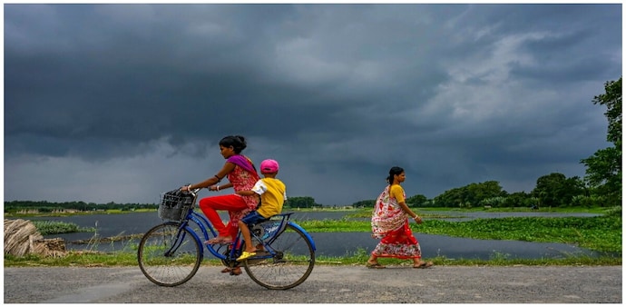
- Sep 21, 2026,
- Updated Sep 21, 2026 7:16 AM IST
The India Meteorological Department (IMD) has forecast widespread rainfall, heavy to very heavy showers, thunderstorms and strong winds across several parts of India between September 20 and 26, with the most intense weather expected over Odisha, Andhra Pradesh, Chhattisgarh, Telangana, Madhya Pradesh, West Bengal, Jharkhand and parts of southern India.
A low-pressure system over the Bay of Bengal is expected to strengthen into a depression and then a deep depression, driving heavy rain and squally weather along the east coast.
The low-pressure area over the eastcentral Bay of Bengal and adjoining north Andaman Sea was lying over the eastcentral Bay of Bengal at 5:30 pm on September 20.
The system is expected to intensify into a depression on September 21 and a deep depression over the westcentral Bay of Bengal on September 22. It is likely to move towards the north Andhra Pradesh-south Odisha coast around the morning of September 23.
The IMD has warned of worsening sea conditions as the system intensifies.
Winds over parts of the Bay of Bengal could increase from 40-50 kmph, gusting to 60 kmph on September 20, to 50-60 kmph, gusting to 70 kmph on September 22. On September 23, winds may reach 55-65 kmph, gusting to 75 kmph, over the westcentral and adjoining northwest Bay of Bengal, persisting until September 24 evening.
Squally winds of 55-65 kmph are expected along and off the south Odisha-north Andhra Pradesh coasts on September 23-24.
Odisha, Andhra Pradesh face heaviest rain
The IMD has forecast heavy to very heavy rainfall with isolated extremely heavy rainfall over coastal Andhra Pradesh and Odisha on September 23 and 24.
North coastal Andhra Pradesh could receive isolated very heavy rain from September 22-24, while south Odisha faces very heavy rainfall from September 22-25.
On September 24, isolated extremely heavy rainfall is also likely over Chhattisgarh, coastal Andhra Pradesh and Odisha. Telangana and Vidarbha could receive heavy to very heavy rainfall.
Thundersqualls with winds of 50-60 kmph are likely over Odisha and Telangana on September 23-24.
September 20-22: Rain spreads across east and south
For September 20, heavy to very heavy rainfall was forecast over coastal Andhra Pradesh, Kerala & Mahe and Tamil Nadu, Puducherry & Karaikal. Heavy rain was also likely over the Andaman & Nicobar Islands, Chhattisgarh, East Madhya Pradesh, Karnataka, Odisha, Rayalaseema, Saurashtra & Kutch and Telangana.
On September 21, isolated heavy rainfall is expected over the Andaman & Nicobar Islands, Chhattisgarh, coastal Andhra Pradesh, Karnataka, Madhya Maharashtra, Tamil Nadu, Puducherry & Karaikal and Telangana.
On September 22, heavy to very heavy rain is forecast over coastal Andhra Pradesh and Odisha, with heavy rain over Chhattisgarh, Gangetic West Bengal, Karnataka, Maharashtra, parts of the Northeast and Telangana.
Eastern and central India remain on alert
Gangetic West Bengal and the Andaman & Nicobar Islands are likely to see fairly widespread to widespread rainfall from September 20-26. Jharkhand, Odisha and Sub-Himalayan West Bengal & Sikkim are expected to receive widespread rain from September 22-26, while Bihar could see widespread rainfall from September 24-26.
The IMD has warned of moderate to severe lightning activity over Jharkhand on September 21-22 and Gangetic West Bengal from September 22-25.
Central India will also see prolonged rainfall. Widespread rain is forecast over Vidarbha from September 21-26, East Madhya Pradesh from September 23-26 and Chhattisgarh from September 20-26. South Chhattisgarh could receive isolated extremely heavy rainfall on September 24.
South India to remain wet
Kerala, Karnataka, Telangana and coastal Andhra Pradesh are expected to remain active weather zones.
Fairly widespread to widespread rain is forecast over Kerala on September 20-21 and September 24-25, coastal and interior Karnataka from September 20-25, coastal Andhra Pradesh from September 22-24, and Telangana from September 21-26.
UP, Delhi-NCR could see rain later
The weather system is expected to affect northwest India towards the end of the forecast period.
East Uttar Pradesh could receive fairly widespread to widespread rain with thunderstorms on September 25-26, while West Uttar Pradesh may see isolated heavy rain during the same period. East Uttar Pradesh is also under a heavy-rainfall watch from September 24-26.
Thunderstorms and lightning are possible over Haryana, Chandigarh, Delhi and Uttar Pradesh on September 25-26.
Monsoon withdrawal continues
The Southwest Monsoon withdrawal is progressing, with conditions favourable for further withdrawal from parts of Rajasthan, Punjab and Saurashtra & Kutch over the next two to three days.
However, the strengthening Bay of Bengal system is expected to dominate weather conditions across eastern and central India through the middle of the week.
The IMD has warned that heavy rain and strong winds could cause waterlogging, localised flooding, inundation, landslides and mudslides, besides affecting road and rail traffic.
Trees and branches could be uprooted, while vulnerable houses, roads, plantations, horticulture and standing crops may suffer damage. Small boats and trawlers could also be affected, while heavy rain may reduce visibility and disrupt helicopter services.
The India Meteorological Department (IMD) has forecast widespread rainfall, heavy to very heavy showers, thunderstorms and strong winds across several parts of India between September 20 and 26, with the most intense weather expected over Odisha, Andhra Pradesh, Chhattisgarh, Telangana, Madhya Pradesh, West Bengal, Jharkhand and parts of southern India.
A low-pressure system over the Bay of Bengal is expected to strengthen into a depression and then a deep depression, driving heavy rain and squally weather along the east coast.
The low-pressure area over the eastcentral Bay of Bengal and adjoining north Andaman Sea was lying over the eastcentral Bay of Bengal at 5:30 pm on September 20.
The system is expected to intensify into a depression on September 21 and a deep depression over the westcentral Bay of Bengal on September 22. It is likely to move towards the north Andhra Pradesh-south Odisha coast around the morning of September 23.
The IMD has warned of worsening sea conditions as the system intensifies.
Winds over parts of the Bay of Bengal could increase from 40-50 kmph, gusting to 60 kmph on September 20, to 50-60 kmph, gusting to 70 kmph on September 22. On September 23, winds may reach 55-65 kmph, gusting to 75 kmph, over the westcentral and adjoining northwest Bay of Bengal, persisting until September 24 evening.
Squally winds of 55-65 kmph are expected along and off the south Odisha-north Andhra Pradesh coasts on September 23-24.
Odisha, Andhra Pradesh face heaviest rain
The IMD has forecast heavy to very heavy rainfall with isolated extremely heavy rainfall over coastal Andhra Pradesh and Odisha on September 23 and 24.
North coastal Andhra Pradesh could receive isolated very heavy rain from September 22-24, while south Odisha faces very heavy rainfall from September 22-25.
On September 24, isolated extremely heavy rainfall is also likely over Chhattisgarh, coastal Andhra Pradesh and Odisha. Telangana and Vidarbha could receive heavy to very heavy rainfall.
Thundersqualls with winds of 50-60 kmph are likely over Odisha and Telangana on September 23-24.
September 20-22: Rain spreads across east and south
For September 20, heavy to very heavy rainfall was forecast over coastal Andhra Pradesh, Kerala & Mahe and Tamil Nadu, Puducherry & Karaikal. Heavy rain was also likely over the Andaman & Nicobar Islands, Chhattisgarh, East Madhya Pradesh, Karnataka, Odisha, Rayalaseema, Saurashtra & Kutch and Telangana.
On September 21, isolated heavy rainfall is expected over the Andaman & Nicobar Islands, Chhattisgarh, coastal Andhra Pradesh, Karnataka, Madhya Maharashtra, Tamil Nadu, Puducherry & Karaikal and Telangana.
On September 22, heavy to very heavy rain is forecast over coastal Andhra Pradesh and Odisha, with heavy rain over Chhattisgarh, Gangetic West Bengal, Karnataka, Maharashtra, parts of the Northeast and Telangana.
Eastern and central India remain on alert
Gangetic West Bengal and the Andaman & Nicobar Islands are likely to see fairly widespread to widespread rainfall from September 20-26. Jharkhand, Odisha and Sub-Himalayan West Bengal & Sikkim are expected to receive widespread rain from September 22-26, while Bihar could see widespread rainfall from September 24-26.
The IMD has warned of moderate to severe lightning activity over Jharkhand on September 21-22 and Gangetic West Bengal from September 22-25.
Central India will also see prolonged rainfall. Widespread rain is forecast over Vidarbha from September 21-26, East Madhya Pradesh from September 23-26 and Chhattisgarh from September 20-26. South Chhattisgarh could receive isolated extremely heavy rainfall on September 24.
South India to remain wet
Kerala, Karnataka, Telangana and coastal Andhra Pradesh are expected to remain active weather zones.
Fairly widespread to widespread rain is forecast over Kerala on September 20-21 and September 24-25, coastal and interior Karnataka from September 20-25, coastal Andhra Pradesh from September 22-24, and Telangana from September 21-26.
UP, Delhi-NCR could see rain later
The weather system is expected to affect northwest India towards the end of the forecast period.
East Uttar Pradesh could receive fairly widespread to widespread rain with thunderstorms on September 25-26, while West Uttar Pradesh may see isolated heavy rain during the same period. East Uttar Pradesh is also under a heavy-rainfall watch from September 24-26.
Thunderstorms and lightning are possible over Haryana, Chandigarh, Delhi and Uttar Pradesh on September 25-26.
Monsoon withdrawal continues
The Southwest Monsoon withdrawal is progressing, with conditions favourable for further withdrawal from parts of Rajasthan, Punjab and Saurashtra & Kutch over the next two to three days.
However, the strengthening Bay of Bengal system is expected to dominate weather conditions across eastern and central India through the middle of the week.
The IMD has warned that heavy rain and strong winds could cause waterlogging, localised flooding, inundation, landslides and mudslides, besides affecting road and rail traffic.
Trees and branches could be uprooted, while vulnerable houses, roads, plantations, horticulture and standing crops may suffer damage. Small boats and trawlers could also be affected, while heavy rain may reduce visibility and disrupt helicopter services.