
Pacific temperatures could hit 3°C above normal: Will 2026 ‘Super El Niño’ rewrite weather records?
The major El Niño events of 1982-83, 1997-98 and 2015-16 produced significant disruptions worldwide. A new event approaching their intensity would put governments and communities on alert.
- Aug 23, 2026,
- Updated Aug 23, 2026 1:46 PM IST
The Pacific is sending a warning signal. Ocean temperatures are climbing sharply, forecasts point to an exceptionally powerful El Niño, and its effects could soon extend far beyond the tropical Pacific. From India’s monsoon to global temperatures and tropical cyclones, the developing event could disrupt weather patterns across continents.
What makes this El Niño particularly concerning is its potential scale. Forecasts suggest Pacific waters could become around 3°C warmer than average, pushing the phenomenon into the category of a “Super El Niño”. If projections hold, it could rival or surpass the strongest El Niño events recorded in modern times.
What is driving this El Niño?
El Niño occurs when unusually warm water in the tropical Pacific shifts eastward and releases large amounts of heat into the atmosphere. That heat alters atmospheric circulation, affecting rainfall, temperatures and storm patterns thousands of kilometres away.
The current event has been strengthening since its declaration in June. Sea-surface temperatures across key parts of the Pacific have already reached unusually high levels, and the event is expected to intensify before reaching its peak later in the year.
The projected strength is what has caught scientists' attention. The major El Niño events of 1982-83, 1997-98 and 2015-16 produced significant disruptions worldwide. A new event approaching their intensity would put governments and communities on alert.
Why India is watching closely
For India, rainfall is one of the biggest concerns. El Niño has historically been associated with weaker Indian monsoons, although the relationship is not consistent enough to predict rainfall from El Niño alone. Other ocean and atmospheric factors also influence the monsoon.
Still, a powerful El Niño arriving alongside an already complex monsoon season could increase the risk of rainfall deficits in some parts of the country.
The consequences could extend from farms to reservoirs. Poor rainfall can affect crop production, water availability, hydropower generation and rural incomes, making the Pacific climate signal relevant to India's economy as well as its weather.
Could it push global temperatures even higher?
The potential impact goes beyond rainfall. El Niño releases heat stored in the Pacific into the atmosphere. That can temporarily raise global average temperatures.
This natural warming effect is now occurring against a much warmer baseline because of human-driven climate change. That combination could make the coming period particularly hot.
There is also a delay between the development of El Niño and its full impact on global temperatures. As a result, the strongest warming influence may arrive after the Pacific event itself reaches its peak. This raises the possibility of another record-breaking year for global temperatures.
What past Super El Niños tell us
The strongest El Niño events of recent decades have been associated with a wide range of disruptions.
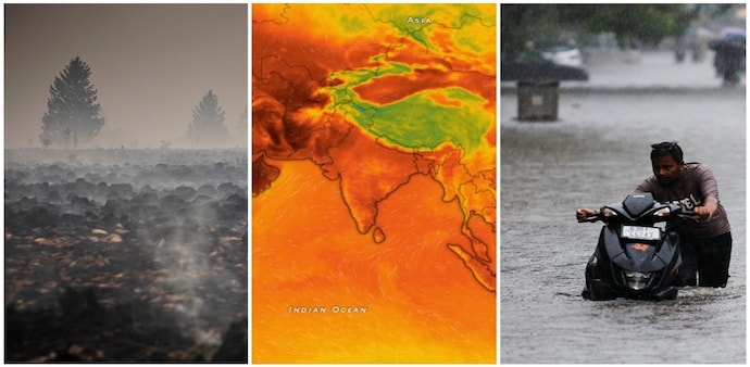
Some regions experience severe drought while others face unusually heavy rainfall and flooding. Tropical cyclone activity can also shift as atmospheric circulation and ocean temperatures change.
The important point is that El Niño does not produce one uniform global outcome. It rearranges the climate system, creating winners and losers depending on location.
For countries already vulnerable to extreme heat, water shortages or intense rainfall, that added volatility can become a serious challenge.
Climate backdrop has changed
There is another reason scientists are paying close attention. El Niño itself is a natural climate phenomenon. Climate change did not create it. But today's El Niño is developing on a planet that is significantly warmer than it was during previous major events.
That matters because the same natural climate event can have different consequences when temperatures are already elevated.
A very strong El Niño could therefore deliver another substantial burst of heat to a world already experiencing increasingly frequent temperature records.
The Pacific is sending a warning signal. Ocean temperatures are climbing sharply, forecasts point to an exceptionally powerful El Niño, and its effects could soon extend far beyond the tropical Pacific. From India’s monsoon to global temperatures and tropical cyclones, the developing event could disrupt weather patterns across continents.
What makes this El Niño particularly concerning is its potential scale. Forecasts suggest Pacific waters could become around 3°C warmer than average, pushing the phenomenon into the category of a “Super El Niño”. If projections hold, it could rival or surpass the strongest El Niño events recorded in modern times.
What is driving this El Niño?
El Niño occurs when unusually warm water in the tropical Pacific shifts eastward and releases large amounts of heat into the atmosphere. That heat alters atmospheric circulation, affecting rainfall, temperatures and storm patterns thousands of kilometres away.
The current event has been strengthening since its declaration in June. Sea-surface temperatures across key parts of the Pacific have already reached unusually high levels, and the event is expected to intensify before reaching its peak later in the year.
The projected strength is what has caught scientists' attention. The major El Niño events of 1982-83, 1997-98 and 2015-16 produced significant disruptions worldwide. A new event approaching their intensity would put governments and communities on alert.
Why India is watching closely
For India, rainfall is one of the biggest concerns. El Niño has historically been associated with weaker Indian monsoons, although the relationship is not consistent enough to predict rainfall from El Niño alone. Other ocean and atmospheric factors also influence the monsoon.
Still, a powerful El Niño arriving alongside an already complex monsoon season could increase the risk of rainfall deficits in some parts of the country.
The consequences could extend from farms to reservoirs. Poor rainfall can affect crop production, water availability, hydropower generation and rural incomes, making the Pacific climate signal relevant to India's economy as well as its weather.
Could it push global temperatures even higher?
The potential impact goes beyond rainfall. El Niño releases heat stored in the Pacific into the atmosphere. That can temporarily raise global average temperatures.
This natural warming effect is now occurring against a much warmer baseline because of human-driven climate change. That combination could make the coming period particularly hot.
There is also a delay between the development of El Niño and its full impact on global temperatures. As a result, the strongest warming influence may arrive after the Pacific event itself reaches its peak. This raises the possibility of another record-breaking year for global temperatures.
What past Super El Niños tell us
The strongest El Niño events of recent decades have been associated with a wide range of disruptions.
Some regions experience severe drought while others face unusually heavy rainfall and flooding. Tropical cyclone activity can also shift as atmospheric circulation and ocean temperatures change.
The important point is that El Niño does not produce one uniform global outcome. It rearranges the climate system, creating winners and losers depending on location.
For countries already vulnerable to extreme heat, water shortages or intense rainfall, that added volatility can become a serious challenge.
Climate backdrop has changed
There is another reason scientists are paying close attention. El Niño itself is a natural climate phenomenon. Climate change did not create it. But today's El Niño is developing on a planet that is significantly warmer than it was during previous major events.
That matters because the same natural climate event can have different consequences when temperatures are already elevated.
A very strong El Niño could therefore deliver another substantial burst of heat to a world already experiencing increasingly frequent temperature records.