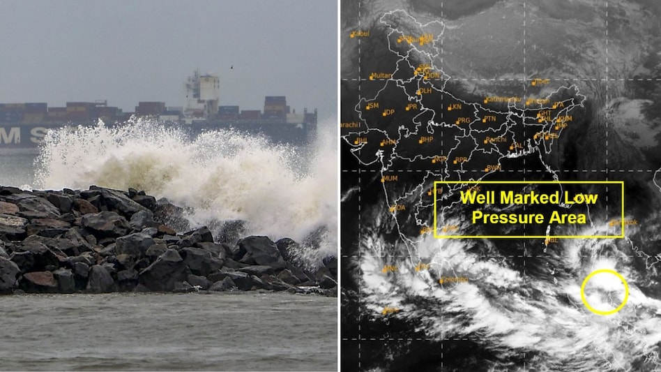
Cyclone Senyar likely to hit Tamil Nadu, Kerala: Low-pressure system over Bay of Bengal strengthens
Sea conditions remain rough to very rough across the Andaman Sea, the Strait of Malacca, and waters around the Nicobar Islands, Malaysia, west Indonesia and Thailand

- Nov 26, 2025,
- Updated Nov 26, 2025 8:10 AM IST
A low-pressure system churning over the southwest Bay of Bengal and adjoining south Sri Lanka remains active and is expected to strengthen further, the India Meteorological Department (IMD) said on Saturday, warning that the disturbance is on track to intensify as it moves westwards over the next 24 hours.
The IMD noted that the system is currently marked by scattered to broken low and medium clouds with embedded convection spread across the southwest and west-central Bay of Bengal, the Tamil Nadu and Andhra Pradesh coasts, west Sri Lanka, and parts of the central Bay of Bengal and the equatorial Indian Ocean.
The estimated central pressure stands at 1006 hPa, with maximum sustained winds of 20–25 knots, gusting to 35 knots. Sea conditions remain rough to very rough across the Andaman Sea, the Strait of Malacca, and waters around the Nicobar Islands, Malaysia, west Indonesia and Thailand.
If the system intensifies into a cyclonic storm, it will be named ‘Senyar’, meaning lion, a name contributed by the United Arab Emirates under the rotating list of cyclone names for the North Indian Ocean. Under IMD protocol, naming begins only once a deep depression strengthens into a full cyclonic storm.
Rainfall forecast for south India and Andaman region
According to the IMD, heavy rainfall is likely over:
-
Tamil Nadu: November 25–30 (very heavy on November 28–30)
-
Kerala & Mahe: November 25–26
-
Andaman & Nicobar Islands: November 25–29 (very heavy on November 26–27)
-
Coastal Andhra Pradesh, Yanam & Rayalaseema: November 29–December 1 (very heavy on November 30)
Thunderstorms with lightning are also expected over Tamil Nadu (Nov 25–29), Kerala and Mahe (Nov 25–27), Lakshadweep (Nov 25), Coastal Andhra Pradesh, Yanam and Rayalaseema (Nov 28–29), and the Andaman & Nicobar Islands, where gusty winds may reach 30–40 kmph on November 29, 40–50 kmph on November 25, and 50–60 kmph between November 26–28.
