
China's $170-billion Brahmaputra mega dam sits atop an active fault. What does it mean for India?
Chinese authorities have positioned the project as a key pillar of the country's clean energy strategy. Once operational, it is expected to generate around 300 billion kilowatt-hours of electricity annually, making it one of the most significant renewable energy projects ever undertaken.
- Jul 10, 2026,
- Updated Jul 10, 2026 10:19 PM IST
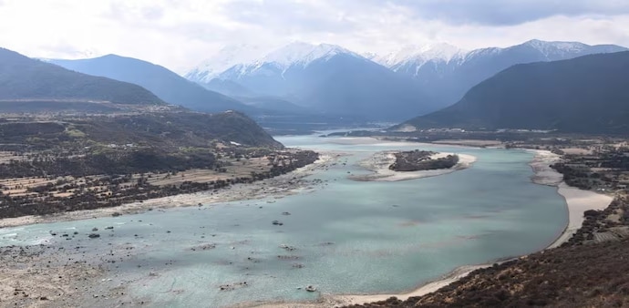
China's most ambitious hydropower project has encountered an unexpected hurdle—not from politics or funding, but from the ground beneath it. As construction advances on the massive dam planned across the Yarlung Tsangpo River in Tibet, Chinese geologists have warned that the site sits above an active fault line that could pose long-term risks to the project's stability.
The warning comes from a study published in the Chinese-language journal c, overseen by the state-backed China Geological Survey. The findings have added a new dimension to an engineering project already under international scrutiny because of its scale and strategic location.
The latest findings are notable because they come from Chinese scientists themselves rather than external critics. Their assessment does not call for abandoning the project but highlights the importance of designing infrastructure capable of withstanding one of the world's most dynamic geological environments.
An Ice Age fault still on the move
According to the researchers, the Paizhen Fault has remained active since the Pleistocene, or Ice Age. Their study suggests that continued geological movement along the fault could affect critical infrastructure in the region, including dams, tunnels, bridges and highways.
Rather than questioning whether the project should proceed, the researchers have called for stronger engineering safeguards. They recommend reinforcing vulnerable slopes and installing retaining structures to reduce the risk of landslides and rockfalls around the construction site.
World's largest hydropower ambition
The dam, being built on the lower reaches of the Yarlung Tsangpo River, is expected to become the world's largest hydropower project, surpassing the Three Gorges Dam in both scale and electricity generation.
Chinese authorities have positioned the project as a key pillar of the country's clean energy strategy. Once operational, it is expected to generate around 300 billion kilowatt-hours of electricity annually, making it one of the most significant renewable energy projects ever undertaken.
A region shaped by earthquakes
The eastern Himalayas are among the most geologically active regions on Earth. The landscape has been shaped by the ongoing collision between the Indian and Eurasian tectonic plates, creating steep mountains, deep gorges and unstable terrain.
These conditions have long made the region one of the most challenging places for large-scale infrastructure projects. The latest study underscores the need for continuous geological monitoring throughout both the construction phase and the dam's operational life.
Why India is watching closely
Beyond the engineering challenges, the project has significant geopolitical implications. The Yarlung Tsangpo flows into India as the Brahmaputra River before continuing into Bangladesh, making it a vital transboundary river.
India has repeatedly expressed concerns over the potential downstream impact of the project, particularly on water security, sediment transport and the river's ecological balance. China has maintained that the hydropower project is designed primarily for electricity generation and will not significantly alter downstream water flows.
China's most ambitious hydropower project has encountered an unexpected hurdle—not from politics or funding, but from the ground beneath it. As construction advances on the massive dam planned across the Yarlung Tsangpo River in Tibet, Chinese geologists have warned that the site sits above an active fault line that could pose long-term risks to the project's stability.
The warning comes from a study published in the Chinese-language journal c, overseen by the state-backed China Geological Survey. The findings have added a new dimension to an engineering project already under international scrutiny because of its scale and strategic location.
The latest findings are notable because they come from Chinese scientists themselves rather than external critics. Their assessment does not call for abandoning the project but highlights the importance of designing infrastructure capable of withstanding one of the world's most dynamic geological environments.
An Ice Age fault still on the move
According to the researchers, the Paizhen Fault has remained active since the Pleistocene, or Ice Age. Their study suggests that continued geological movement along the fault could affect critical infrastructure in the region, including dams, tunnels, bridges and highways.
Rather than questioning whether the project should proceed, the researchers have called for stronger engineering safeguards. They recommend reinforcing vulnerable slopes and installing retaining structures to reduce the risk of landslides and rockfalls around the construction site.
World's largest hydropower ambition
The dam, being built on the lower reaches of the Yarlung Tsangpo River, is expected to become the world's largest hydropower project, surpassing the Three Gorges Dam in both scale and electricity generation.
Chinese authorities have positioned the project as a key pillar of the country's clean energy strategy. Once operational, it is expected to generate around 300 billion kilowatt-hours of electricity annually, making it one of the most significant renewable energy projects ever undertaken.
A region shaped by earthquakes
The eastern Himalayas are among the most geologically active regions on Earth. The landscape has been shaped by the ongoing collision between the Indian and Eurasian tectonic plates, creating steep mountains, deep gorges and unstable terrain.
These conditions have long made the region one of the most challenging places for large-scale infrastructure projects. The latest study underscores the need for continuous geological monitoring throughout both the construction phase and the dam's operational life.
Why India is watching closely
Beyond the engineering challenges, the project has significant geopolitical implications. The Yarlung Tsangpo flows into India as the Brahmaputra River before continuing into Bangladesh, making it a vital transboundary river.
India has repeatedly expressed concerns over the potential downstream impact of the project, particularly on water security, sediment transport and the river's ecological balance. China has maintained that the hydropower project is designed primarily for electricity generation and will not significantly alter downstream water flows.