
What makes an El Niño ‘super’ – and why this one could be especially severe
El Niño typically occurs every two to seven years when weakening trade winds allow warmer water to build up in the eastern Pacific.
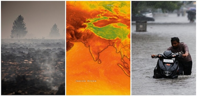
- Sep 25, 2026,
- Updated Sep 25, 2026 6:00 AM IST
The developing El Niño could become one of the strongest on record, with the Climate Impact Lab at the University of Chicago estimating that it could result in 451,000 excess deaths by February. The World Meteorological Organization expects the phenomenon to reach peak intensity by early 2027.
But what exactly makes an El Niño “super”?
To begin with, El Niño is the warm phase of the naturally occurring El Niño-Southern Oscillation (ENSO) cycle, which influences weather around the world.
It typically occurs every two to seven years when weakening trade winds allow warmer water to build up in the eastern Pacific. The phenomenon generally raises global temperatures and disrupts rainfall patterns, producing drought in some regions and heavy rainfall in others.
Now, the key indicator is the temperature of the Pacific Ocean. This month, equatorial Pacific sea surface temperatures were 3.05°C above normal, the highest temperature anomaly recorded for any El Niño since records began, according to the US National Oceanic and Atmospheric Administration (NOAA).
That is far above the 0.5°C threshold used to define El Niño conditions. NOAA classifies events according to their temperature anomaly:
0.5°C: Weak El Niño 1.0°C: Moderate El Niño 1.5°C: Strong El Niño 2.0°C: Very strong El Niño
The World Meteorological Organization does not officially use the term “super El Niño”. However, it has forecast that the current event will intensify into a “very strong event”, with significant effects on rainfall and temperatures.
Is it because of climate change?
No. El Niño is a natural climate pattern and is not caused by climate change. However, the last strong El Niño, in 2023-24, combined with climate change to push 2024 to become the planet's hottest year on record.
That period saw disastrous fires in Bolivia and Venezuela, torrential flooding in Nepal, Sudan and Spain, and deadly heatwaves in Mexico and Saudi Arabia.
What could this El Niño mean?
The developing event could bring floods, drought, extreme heat and crop losses around the world.
Southern South America and parts of Central Asia typically receive more rain during El Niño, increasing flood risks. Southern Africa, Central America and Australia tend to become drier, threatening agriculture and hydropower.
The UN World Food Programme estimates nearly 50 million people could face acute hunger by the end of 2027, with southern Africa and South America among the worst-hit regions.
The developing El Niño could become one of the strongest on record, with the Climate Impact Lab at the University of Chicago estimating that it could result in 451,000 excess deaths by February. The World Meteorological Organization expects the phenomenon to reach peak intensity by early 2027.
But what exactly makes an El Niño “super”?
To begin with, El Niño is the warm phase of the naturally occurring El Niño-Southern Oscillation (ENSO) cycle, which influences weather around the world.
It typically occurs every two to seven years when weakening trade winds allow warmer water to build up in the eastern Pacific. The phenomenon generally raises global temperatures and disrupts rainfall patterns, producing drought in some regions and heavy rainfall in others.
Now, the key indicator is the temperature of the Pacific Ocean. This month, equatorial Pacific sea surface temperatures were 3.05°C above normal, the highest temperature anomaly recorded for any El Niño since records began, according to the US National Oceanic and Atmospheric Administration (NOAA).
That is far above the 0.5°C threshold used to define El Niño conditions. NOAA classifies events according to their temperature anomaly:
0.5°C: Weak El Niño 1.0°C: Moderate El Niño 1.5°C: Strong El Niño 2.0°C: Very strong El Niño
The World Meteorological Organization does not officially use the term “super El Niño”. However, it has forecast that the current event will intensify into a “very strong event”, with significant effects on rainfall and temperatures.
Is it because of climate change?
No. El Niño is a natural climate pattern and is not caused by climate change. However, the last strong El Niño, in 2023-24, combined with climate change to push 2024 to become the planet's hottest year on record.
That period saw disastrous fires in Bolivia and Venezuela, torrential flooding in Nepal, Sudan and Spain, and deadly heatwaves in Mexico and Saudi Arabia.
What could this El Niño mean?
The developing event could bring floods, drought, extreme heat and crop losses around the world.
Southern South America and parts of Central Asia typically receive more rain during El Niño, increasing flood risks. Southern Africa, Central America and Australia tend to become drier, threatening agriculture and hydropower.
The UN World Food Programme estimates nearly 50 million people could face acute hunger by the end of 2027, with southern Africa and South America among the worst-hit regions.