
Monsoon intensifies after weak spell: IMD sounds alert of heavy rainfall across India till July 26
According to the IMD's extended-range forecast, India received rainfall that was 51% below the Long Period Average (LPA) during the week of July 9-15. Cumulatively, the country recorded a rainfall deficit of 23% between June 1 and July 15.
- Jul 20, 2026,
- Updated Jul 20, 2026 2:57 PM IST
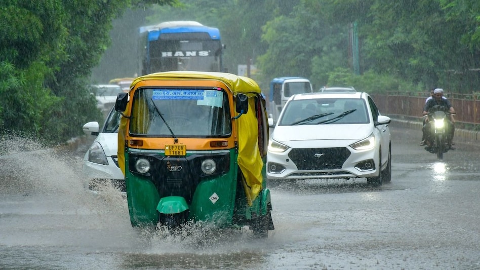
The India Meteorological Department (IMD) today (July 20) issued district-wise red and orange warnings for several states, cautioning that thunderstorms, lightning, gusty winds and heavy rainfall could lash many regions over the next two to three hours as the southwest monsoon entered an active phase across much of the country.
The nowcast, issued at 1:44 pm IST on July 20 and valid until 4:44 pm IST, warns of lightning, thunderstorms with wind speeds of around 60 kmph and heavy rainfall exceeding 15 mm per hour in districts across Gujarat, Uttar Pradesh, Punjab, Haryana and Himachal Pradesh.
Must read | From food prices to power supply: Why monsoon still decides the fate of India’s economy
The short-term warning comes against the backdrop of an expected revival in monsoon activity. According to the IMD's latest weather bulletin, heavy to very heavy rainfall is likely over several parts of northwest, central, east and northeast India between July 20 and July 26, with isolated extremely heavy rainfall expected over some regions during the period.
Districts under red warning
The IMD has placed the following districts under red alert, indicating the highest level of weather risk:
- Gujarat: Dadra & Nagar Haveli, Daman, Navsari and Valsad.
- Uttar Pradesh: Hardoi and Unnao.
- Punjab: Chandigarh, Fatehgarh Sahib, Gurdaspur, Hoshiarpur, Nawashahr, Pathankot, Rupnagar and SAS Nagar.
- Haryana: Ambala and Panchkula.
- Himachal Pradesh: Kangra, Sirmaur, Solan and Una.
Residents in these districts could experience intense thunderstorms, frequent lightning, strong winds reaching around 60 kmph, and heavy rain capable of causing waterlogging, poor visibility and disruption to road traffic.
DON'T MISS | Big climate warning for India: New study finds global rainfall is on the move
Orange alert across 13 states
The IMD has also issued orange warnings for thunderstorms, lightning, gusty winds of 40-60 kmph and moderate rainfall of 5-15 mm per hour across parts of: Meghalaya, Assam, Uttar Pradesh, Maharashtra, Gujarat, Chhattisgarh, Madhya Pradesh, West Bengal, Bihar, Haryana, Uttarakhand, Punjab and Himachal Pradesh.
Major districts under the orange warning include Lucknow, Kanpur Nagar, Prayagraj, Meerut, Surat, Vadodara, Palghar, Raigad, Dehradun, Haridwar, Ludhiana, Patiala, Shimla and Murshidabad, among several others.
FIND WHY | Monsoon 2026: How rainfall drives rural gold demand and credit cycles in India
Active monsoon to persist till July 26
The IMD said the southwest monsoon is expected to remain active over large parts of the country over the coming week.
Its latest forecast indicates:
- July 20-22: Heavy to very heavy rainfall is likely over Punjab, Haryana, Himachal Pradesh, Uttarakhand and adjoining parts of northwest India.
- July 20-26: Widespread rainfall accompanied by thunderstorms and lightning is expected across east, central and northeast India.
- July 20-23: Heavy rainfall is likely over Konkan and Goa, parts of Maharashtra and the adjoining west coast.
- Throughout the week: Flash floods, landslides and waterlogging remain possible in vulnerable areas of Himachal Pradesh and Uttarakhand.
While rainfall activity is expected to strengthen across northern and eastern India, the IMD said monsoon conditions are likely to remain comparatively subdued over parts of west-central and peninsular India.
DO CHECKOUT | Inside India’s agricultural matrix: How the monsoon shapes farming cycle & crop yields
Rainfall deficit remains significant
The fresh spell of rain follows a relatively weak phase of the southwest monsoon earlier this month.
According to the IMD's extended-range forecast, India received rainfall that was 51% below the Long Period Average (LPA) during the week of July 9-15. Cumulatively, the country recorded a rainfall deficit of 23% between June 1 and July 15, underscoring the need for sustained rainfall during the second half of the season.
The rainfall shortfall has been particularly evident across parts of northwest India, including Punjab and Haryana. The IMD expects the ongoing spell of rain to help narrow the deficit over the coming days.
Why the weather is turning intense
The current weather pattern is being driven by an active southwest monsoon, supported by favourable synoptic conditions that are enhancing moisture transport into northern, eastern and northeastern India.
SEE WHY | Beyond waterproofing: Why home insurance matters during the monsoon season
These conditions are expected to trigger widespread showers, isolated heavy downpours, thunderstorms, lightning and strong surface winds across several states over the next week. The IMD has urged residents in affected districts to remain vigilant and follow safety precautions during thunderstorms and heavy rain.
The India Meteorological Department (IMD) today (July 20) issued district-wise red and orange warnings for several states, cautioning that thunderstorms, lightning, gusty winds and heavy rainfall could lash many regions over the next two to three hours as the southwest monsoon entered an active phase across much of the country.
The nowcast, issued at 1:44 pm IST on July 20 and valid until 4:44 pm IST, warns of lightning, thunderstorms with wind speeds of around 60 kmph and heavy rainfall exceeding 15 mm per hour in districts across Gujarat, Uttar Pradesh, Punjab, Haryana and Himachal Pradesh.
Must read | From food prices to power supply: Why monsoon still decides the fate of India’s economy
The short-term warning comes against the backdrop of an expected revival in monsoon activity. According to the IMD's latest weather bulletin, heavy to very heavy rainfall is likely over several parts of northwest, central, east and northeast India between July 20 and July 26, with isolated extremely heavy rainfall expected over some regions during the period.
Districts under red warning
The IMD has placed the following districts under red alert, indicating the highest level of weather risk:
- Gujarat: Dadra & Nagar Haveli, Daman, Navsari and Valsad.
- Uttar Pradesh: Hardoi and Unnao.
- Punjab: Chandigarh, Fatehgarh Sahib, Gurdaspur, Hoshiarpur, Nawashahr, Pathankot, Rupnagar and SAS Nagar.
- Haryana: Ambala and Panchkula.
- Himachal Pradesh: Kangra, Sirmaur, Solan and Una.
Residents in these districts could experience intense thunderstorms, frequent lightning, strong winds reaching around 60 kmph, and heavy rain capable of causing waterlogging, poor visibility and disruption to road traffic.
DON'T MISS | Big climate warning for India: New study finds global rainfall is on the move
Orange alert across 13 states
The IMD has also issued orange warnings for thunderstorms, lightning, gusty winds of 40-60 kmph and moderate rainfall of 5-15 mm per hour across parts of: Meghalaya, Assam, Uttar Pradesh, Maharashtra, Gujarat, Chhattisgarh, Madhya Pradesh, West Bengal, Bihar, Haryana, Uttarakhand, Punjab and Himachal Pradesh.
Major districts under the orange warning include Lucknow, Kanpur Nagar, Prayagraj, Meerut, Surat, Vadodara, Palghar, Raigad, Dehradun, Haridwar, Ludhiana, Patiala, Shimla and Murshidabad, among several others.
FIND WHY | Monsoon 2026: How rainfall drives rural gold demand and credit cycles in India
Active monsoon to persist till July 26
The IMD said the southwest monsoon is expected to remain active over large parts of the country over the coming week.
Its latest forecast indicates:
- July 20-22: Heavy to very heavy rainfall is likely over Punjab, Haryana, Himachal Pradesh, Uttarakhand and adjoining parts of northwest India.
- July 20-26: Widespread rainfall accompanied by thunderstorms and lightning is expected across east, central and northeast India.
- July 20-23: Heavy rainfall is likely over Konkan and Goa, parts of Maharashtra and the adjoining west coast.
- Throughout the week: Flash floods, landslides and waterlogging remain possible in vulnerable areas of Himachal Pradesh and Uttarakhand.
While rainfall activity is expected to strengthen across northern and eastern India, the IMD said monsoon conditions are likely to remain comparatively subdued over parts of west-central and peninsular India.
DO CHECKOUT | Inside India’s agricultural matrix: How the monsoon shapes farming cycle & crop yields
Rainfall deficit remains significant
The fresh spell of rain follows a relatively weak phase of the southwest monsoon earlier this month.
According to the IMD's extended-range forecast, India received rainfall that was 51% below the Long Period Average (LPA) during the week of July 9-15. Cumulatively, the country recorded a rainfall deficit of 23% between June 1 and July 15, underscoring the need for sustained rainfall during the second half of the season.
The rainfall shortfall has been particularly evident across parts of northwest India, including Punjab and Haryana. The IMD expects the ongoing spell of rain to help narrow the deficit over the coming days.
Why the weather is turning intense
The current weather pattern is being driven by an active southwest monsoon, supported by favourable synoptic conditions that are enhancing moisture transport into northern, eastern and northeastern India.
SEE WHY | Beyond waterproofing: Why home insurance matters during the monsoon season
These conditions are expected to trigger widespread showers, isolated heavy downpours, thunderstorms, lightning and strong surface winds across several states over the next week. The IMD has urged residents in affected districts to remain vigilant and follow safety precautions during thunderstorms and heavy rain.