
El Niño's weather paradox: How one climate event causes floods and droughts
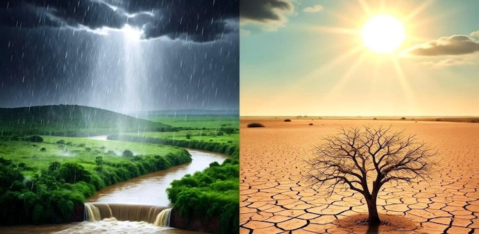
El Niño does not simply make the planet wetter or drier. Instead, it shifts where heat, moisture, rising air and storm systems are concentrated, reshaping weather patterns thousands of kilometres away from the Pacific.
- Sep 27, 2026,
- Updated Sep 27, 2026 2:00 AM IST
The 2026 El Niño is shaping up to be an unusually strong climate event, with the US National Oceanic and Atmospheric Administration (NOAA) giving it a greater than 90% chance of becoming a very strong event during the Northern Hemisphere autumn and winter.
The World Meteorological Organization (WMO) has also warned that the phenomenon could significantly alter rainfall and temperature patterns worldwide, increasing the risk of floods, drought and extreme heat in different regions.
But why can the same El Niño event bring intense rainfall and flooding to one part of the world while leaving another facing drought?
The answer lies in the way unusual warming across the tropical Pacific changes the atmosphere's circulation. El Niño does not simply make the planet wetter or drier. Instead, it shifts where heat, moisture, rising air and storm systems are concentrated, reshaping weather patterns thousands of kilometres away from the Pacific.
MUST READ | India ranks 4th among countries worst hit by heat-related deaths due to Super El Nino. Here's how
Under normal conditions, trade winds blow from east to west across the tropical Pacific, pushing warm surface water towards Indonesia and Australia. This leaves relatively cooler water near the coast of South America and helps create a pattern in which warm, moisture-rich air rises over the western Pacific.
During El Niño, these trade winds weaken or change direction. Warm water spreads eastward across the central and eastern tropical Pacific, increasing sea-surface temperatures in an area that normally remains relatively cooler. That seemingly regional change can disrupt the atmosphere's circulation.
Why does one region get floods while another gets drought?
A key part of the explanation is where air rises and where it sinks.
Warm, moist air tends to rise over areas of unusually warm ocean water, producing clouds and heavy rainfall. Meanwhile, changes in atmospheric circulation can encourage air to descend over other regions. Descending air suppresses cloud formation and rainfall, increasing the risk of drought.
DON'T MISS | What makes an El Niño ‘super’ – and why this one could be especially severe
During El Niño, the centre of tropical Pacific rainfall generally shifts eastward from its usual position closer to Indonesia.
That shift has consequences:
- Central and eastern Pacific regions can experience increased rainfall and storms.
- Indonesia and parts of Australia often face reduced rainfall and heightened drought risk.
- Parts of South America, particularly along the Pacific coast, can receive unusually heavy rainfall.
- Southern parts of the US can experience wetter-than-normal conditions during some El Niño winters, while the northern tier can be warmer or drier.
- Southern and eastern Africa can experience rainfall changes, although the effects vary considerably by season and location.
The important point is that El Niño does not simply make the entire planet wetter or drier. It redistributes atmospheric heating and rainfall.
The role of the jet stream
El Niño can also influence the position and strength of the jet streams — fast-moving bands of air high in the atmosphere. Changes in the Pacific can generate atmospheric waves that propagate toward North America and other parts of the Northern Hemisphere. These waves can shift the path of storms.
For example, an El Niño winter can strengthen or reposition the Pacific jet stream, potentially directing more storms towards the southern United States.
FIND WHY | Super El Niño: UK govt warns people to ready stockpiles amid food security threat
That can mean prolonged periods of rainfall in one area while storm systems bypass another. Why are the impacts different from one El Niño to another? There is no single El Niño weather pattern.
The location of the warmest Pacific waters matters. Scientists often distinguish between eastern-Pacific El Niño events, in which warming is concentrated farther east, and central-Pacific events, where the strongest warming is closer to the central Pacific.
The season also matters. An El Niño event developing during winter can produce a very different regional impact from one peaking during another part of the year.
Other climate patterns also interact with El Niño. The Indian Ocean Dipole, North Atlantic conditions and longer-term background warming can modify the eventual weather response.
As a result, El Niño raises the probability of certain conditions rather than guaranteeing them.
Why can El Niño cause extreme rainfall?
A warmer ocean can provide additional moisture to the atmosphere. When atmospheric circulation directs that moisture toward a particular region, rainfall can become exceptionally intense.
This is particularly important along parts of the western coast of South America, where El Niño-related warming of coastal waters can disrupt the normal atmospheric and oceanic conditions.
IN CASE YOU MISSED | El Niño could turn historic in 2026: ISRO satellite captures major changes in Pacific Ocean
Heavy rainfall can overwhelm drainage systems, swell rivers and trigger landslides and flash floods. And why does it cause drought elsewhere? The same circulation changes that enhance rainfall in one location can suppress it elsewhere.
If a region experiences persistent high pressure and descending air, clouds become less likely to develop. If the pattern lasts for weeks or months, soil moisture can decline, reservoirs can fall and vegetation can become increasingly stressed.
When combined with high temperatures, these conditions can increase wildfire risk and place additional pressure on agriculture and water supplies.
El Niño is not the same as climate change
El Niño is a natural climate pattern, while human-driven climate change is caused primarily by the accumulation of greenhouse gases in the atmosphere. However, the two can interact.
DO READ | El Nino impact? India headed for driest monsoon since 2009, food inflation fears rise: Report
A warmer global climate can influence the background conditions in which El Niño occurs, while an El Niño event can temporarily push global temperatures higher because heat stored in the ocean is redistributed and released into the atmosphere.
This is why a strong El Niño year can produce exceptionally high global temperatures.
The 2026 El Niño is shaping up to be an unusually strong climate event, with the US National Oceanic and Atmospheric Administration (NOAA) giving it a greater than 90% chance of becoming a very strong event during the Northern Hemisphere autumn and winter.
The World Meteorological Organization (WMO) has also warned that the phenomenon could significantly alter rainfall and temperature patterns worldwide, increasing the risk of floods, drought and extreme heat in different regions.
But why can the same El Niño event bring intense rainfall and flooding to one part of the world while leaving another facing drought?
The answer lies in the way unusual warming across the tropical Pacific changes the atmosphere's circulation. El Niño does not simply make the planet wetter or drier. Instead, it shifts where heat, moisture, rising air and storm systems are concentrated, reshaping weather patterns thousands of kilometres away from the Pacific.
MUST READ | India ranks 4th among countries worst hit by heat-related deaths due to Super El Nino. Here's how
Under normal conditions, trade winds blow from east to west across the tropical Pacific, pushing warm surface water towards Indonesia and Australia. This leaves relatively cooler water near the coast of South America and helps create a pattern in which warm, moisture-rich air rises over the western Pacific.
During El Niño, these trade winds weaken or change direction. Warm water spreads eastward across the central and eastern tropical Pacific, increasing sea-surface temperatures in an area that normally remains relatively cooler. That seemingly regional change can disrupt the atmosphere's circulation.
Why does one region get floods while another gets drought?
A key part of the explanation is where air rises and where it sinks.
Warm, moist air tends to rise over areas of unusually warm ocean water, producing clouds and heavy rainfall. Meanwhile, changes in atmospheric circulation can encourage air to descend over other regions. Descending air suppresses cloud formation and rainfall, increasing the risk of drought.
DON'T MISS | What makes an El Niño ‘super’ – and why this one could be especially severe
During El Niño, the centre of tropical Pacific rainfall generally shifts eastward from its usual position closer to Indonesia.
That shift has consequences:
- Central and eastern Pacific regions can experience increased rainfall and storms.
- Indonesia and parts of Australia often face reduced rainfall and heightened drought risk.
- Parts of South America, particularly along the Pacific coast, can receive unusually heavy rainfall.
- Southern parts of the US can experience wetter-than-normal conditions during some El Niño winters, while the northern tier can be warmer or drier.
- Southern and eastern Africa can experience rainfall changes, although the effects vary considerably by season and location.
The important point is that El Niño does not simply make the entire planet wetter or drier. It redistributes atmospheric heating and rainfall.
The role of the jet stream
El Niño can also influence the position and strength of the jet streams — fast-moving bands of air high in the atmosphere. Changes in the Pacific can generate atmospheric waves that propagate toward North America and other parts of the Northern Hemisphere. These waves can shift the path of storms.
For example, an El Niño winter can strengthen or reposition the Pacific jet stream, potentially directing more storms towards the southern United States.
FIND WHY | Super El Niño: UK govt warns people to ready stockpiles amid food security threat
That can mean prolonged periods of rainfall in one area while storm systems bypass another. Why are the impacts different from one El Niño to another? There is no single El Niño weather pattern.
The location of the warmest Pacific waters matters. Scientists often distinguish between eastern-Pacific El Niño events, in which warming is concentrated farther east, and central-Pacific events, where the strongest warming is closer to the central Pacific.
The season also matters. An El Niño event developing during winter can produce a very different regional impact from one peaking during another part of the year.
Other climate patterns also interact with El Niño. The Indian Ocean Dipole, North Atlantic conditions and longer-term background warming can modify the eventual weather response.
As a result, El Niño raises the probability of certain conditions rather than guaranteeing them.
Why can El Niño cause extreme rainfall?
A warmer ocean can provide additional moisture to the atmosphere. When atmospheric circulation directs that moisture toward a particular region, rainfall can become exceptionally intense.
This is particularly important along parts of the western coast of South America, where El Niño-related warming of coastal waters can disrupt the normal atmospheric and oceanic conditions.
IN CASE YOU MISSED | El Niño could turn historic in 2026: ISRO satellite captures major changes in Pacific Ocean
Heavy rainfall can overwhelm drainage systems, swell rivers and trigger landslides and flash floods. And why does it cause drought elsewhere? The same circulation changes that enhance rainfall in one location can suppress it elsewhere.
If a region experiences persistent high pressure and descending air, clouds become less likely to develop. If the pattern lasts for weeks or months, soil moisture can decline, reservoirs can fall and vegetation can become increasingly stressed.
When combined with high temperatures, these conditions can increase wildfire risk and place additional pressure on agriculture and water supplies.
El Niño is not the same as climate change
El Niño is a natural climate pattern, while human-driven climate change is caused primarily by the accumulation of greenhouse gases in the atmosphere. However, the two can interact.
DO READ | El Nino impact? India headed for driest monsoon since 2009, food inflation fears rise: Report
A warmer global climate can influence the background conditions in which El Niño occurs, while an El Niño event can temporarily push global temperatures higher because heat stored in the ocean is redistributed and released into the atmosphere.
This is why a strong El Niño year can produce exceptionally high global temperatures.