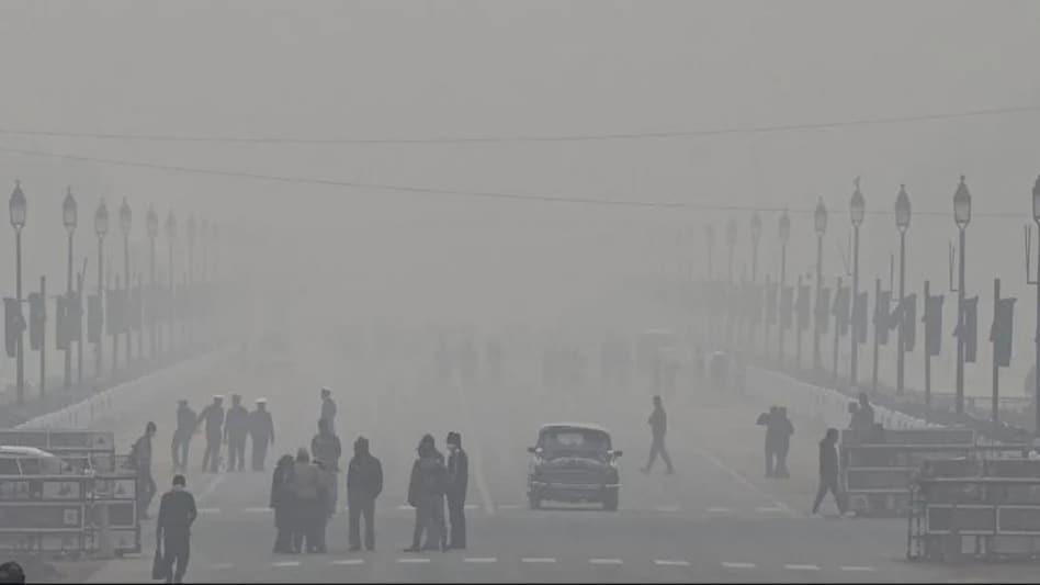
 The weather forecasting agency also said that cold day to severe cold day conditions is very likely in many places over Punjab and Haryana, Chandigarh, and Delhi during the next 24 hours
 The weather forecasting agency also said that cold day to severe cold day conditions is very likely in many places over Punjab and Haryana, Chandigarh, and Delhi during the next 24 hours
The India Meteorological Department (IMD) has predicted cold wave conditions and dense fog in some states including Delhi during the next two days. Among the states that are likely to witness cold wave to severe cold wave conditions are Punjab, Haryana, Chandigarh, and Delhi during the next three days while Himachal is expected to witness these conditions today.
The weather department said due to dry north/northwesterly winds from the Himalayas over the plains of northwest India, cold wave to severe cold wave conditions are very likely in isolated pockets over north Rajasthan during the next three days, and cold wave conditions during the subsequent two days.
"Cold Wave Conditions very likely in isolated pockets over Punjab and Haryana, Chandigarh & Delhi during next 3 days and Himachal Pradesh during next 24 hours," it added.
WATCH: Unusual Christmas Traditions Around The World: Bad Santa, Yule Cat And More
WATCH: Christmas Cake, Yule Log, Rum Balls: Best Christmas Desserts
The weather forecasting agency also said that cold day to severe cold day conditions is very likely in many places over Punjab and Haryana, Chandigarh, and Delhi during the next 24 hours and cold day conditions during subsequent 24 hours over the region. Cold day conditions are also expected in isolated pockets over north Rajasthan during the next 48 hours, it said.
Besides this, the weather department said dense to very dense fog conditions are likely to continue over Punjab and Haryana and dense fog over the remaining parts of the north Indian plains during the next 24 hours. However, a gradual reduction in intensity and spread of dense to very dense fog conditions is likely over Punjab, Haryana, and north Rajasthan from 27th December.
The IMD said the Depression over Southwest Bay of Bengal off Sri Lanka coast moved southwestwards and lay centered over Southwest Bay of Bengal and adjoining Sri Lanka coast, about 80 km east-northeast of Trincomalee (Sri Lanka), 140 km southeast of Jaffna (Sri Lanka), 320 km southeast of Nagappattinam (Tamil Nadu) and 510 km south-southeast of Chennai (Tamil Nadu).
It is likely to continue to move southwestwards and cross Sri Lanka coast to the south of Trincomalee around noon today, 25 December. Thereafter, it would move west southwestwards and emerge into Comorin Area and neighbourhood by tomorrow, 26 December morning.
Due to this weather pattern, light to moderate rainfall at many places with heavy rainfall at isolated places is likely over south coastal Tamil Nadu on the 25 and 26 of December 2022. Also, moderate to heavy rainfall is also likely over south Kerala on Monday, 26 December.