


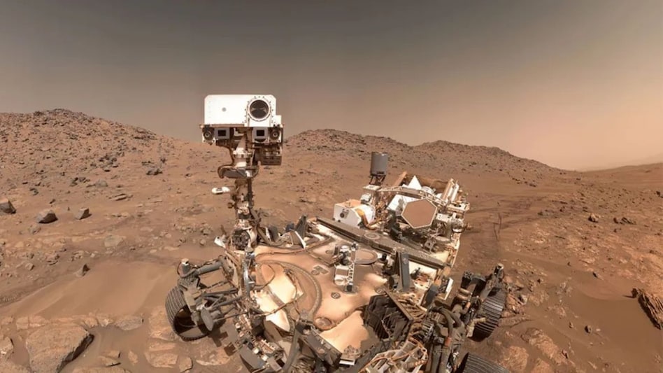
 The AI relied on vision-language models to identify and interpret key terrain features, including boulder fields, exposed bedrock, rocky outcrops, and sand ripples.
NASA’s Perseverance rover has achieved a major first in space exploration: completing drives on Mars that were planned entirely by artificial intelligence, without human route planners guiding every step. The milestone marks a leap forward in autonomous planetary navigation and shows how AI can make complex decisions in environments millions of miles away from Earth.
Traditionally, driving a rover on Mars is a slow and cautious process. Because Mars is, on average, 140 million miles (225 million kilometers) from Earth, commands can’t be sent in real time. Engineers must plan each route in advance, breaking it into short waypoints — usually no more than 330 feet (100 meters) apart — to avoid hazards such as sharp rocks, sand ripples, steep slopes, and uneven ground.

 NSE IPO: India's largest exchange gets 5.68x subscription on Day 3; all categories fully booked
 Indian Oil, HPCL, BPCL shares rise as brent crude prices fall for fourth day
  Bank strike next week: Five-day disruption may hit your salary credits
 Tata Sons power struggle: Who will pay for the next legal battle?
 Semiconductor stocks: Centrum's Nilesh Jain prefers CG Power, Syrma SGS; cautious on Kaynes, Dixon
 Tata Sons Listing Row: Shapoor Mistry Backs IPO As Noel Tata Pushes ₹25,000-Crore Plan
 Takeda, Dr. Reddy’spartner To Bring QDENGA Dengue Vaccine To India; Launch Expected In H1 2027
 Would You Really Upgrade Your iPhone Just For THIS? | The iPhone 18 Pro Debate
 IPO Rush Drains Secondary Market Liquidity; Ajay Bagga On Primary Market & NSE IPO
 Dr. Reddy's Sees Dengue Vaccine Opportunity As QDENGA Launch Nears
 Dr. Reddy’s, Lupin shares among buzzing stocks as pharma sector back in focus
  3 Warren Buffett quotes for Indian stock market investors today
 Sensex jumps 564 points, Nifty tops 23,400; will this upmove sustain?
 Warren Buffett's message to shareholders: Full text of the farewell letter
  Hero MotoCorp, Delhivery shares set for a rebound: Market expert
  Have an Airtel postpaid connection? You may get Apple TV and iCloud+ subscription at no extra cost; Check eligibility
 Your iPhone can alert you when someone calls your name—here is the setting most users may have missedDr. Reddy’s, Lupin shares among buzzing stocks as pharma sector back in focus 3 Warren Buffett quotes for Indian stock market investors today
 What happens if an earthquake strikes at 320 kmph? How 28 sensors will help stop the Mumbai–Ahmedabad bullet train












