


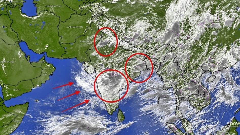
 Central India and Northwest India are now recording near-normal seasonal rainfall. (Photo: Windy)
The southwest monsoon has staged an extraordinary turnaround, overturning forecasts of a below-normal July and dramatically shrinking the country's rainfall deficit in less than a month. According to Climate Trends' report, July 2026 Beats the Forecast as Climate Change and El Niño Rewrite the Monsoon, what began as a worrying season under the shadow of a strengthening El Niño has evolved into one of the biggest weather surprises of the year, reinforcing a growing scientific consensus that climate change is making the monsoon increasingly unpredictable.
At the end of June, India was grappling with a 40% rainfall deficit, triggering concerns over crop sowing, reservoir storage and water availability. By July 29, however, the deficit had narrowed sharply to 16%, thanks to a succession of active monsoon systems that kept rainfall activity alive across much of the country.

 FII sentiment shows early signs of turnaround after months of selling: Report
 UPI should remain free: Expert on why MDR could push merchants and consumers back to cash
 Apple job cuts 2026: iPhone maker slashes 200 jobs in Siri, Vision Pro immersive video, gaming teams
 'Last-minute changes unfair, uneconomic': US-Canada trade talks collapse as Trump readies 50% tariffs on Canadian products
 The $1.8 trillion space economy: Who will capture value as the final frontier goes commercial?
 Meta’s $200 Billion Trial: Did Instagram & Facebook Keep Kids Hooked?
 Motor Insurance Explained: Is Third-Party Car Insurance Enough? Know Before You Buy
 Retirement Tax Planning: 5 Ways Senior Citizens Can Reduce Their Tax Liability
 #IndiaAt100 : Adipen Bose Nandhiji On Conscious Capitalism- Can Profit & Purpose Coexist?
 #IndiaAt100 : Hisashi Takeuchi On Driving India’s Manufacturing Revolution
 Gaja Alternative Assets IPO: 3 ways to check application status; allotment odds, GMP, listing dateFII sentiment shows early signs of turnaround after months of selling: Report
 ₹24,800 crore bill: How transaction costs are eating into retail derivatives trading
 Cupid, NTPC Green, NTPC, Raymond Realty, HAL shares: Key technical levels to watch
 Defence stock with Rs 2,654-crore order book hits record high; here's why
  US/UK citizenship and PPF: What happens to your Indian savings after naturalisation?
 The Rs 606 problem: What happens when India puts a price on UPIUPI should remain free: Expert on why MDR could push merchants and consumers back to cash
 'Before 2019, my son had to change school every year': Maharashtra FDA boss Tukaram Mundhe of 25 transfers in 21 yearsMeta’s $200 Billion Trial: Did Instagram & Facebook Keep Kids Hooked?












