


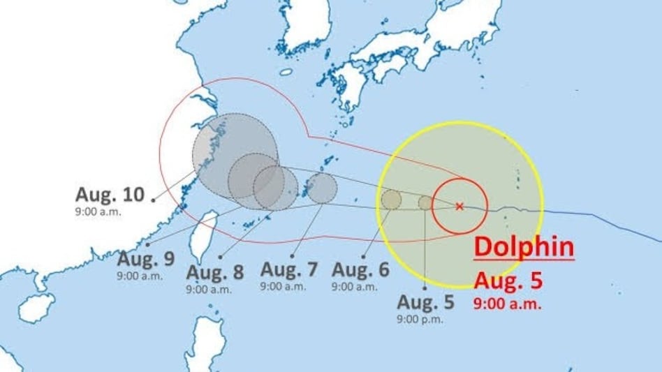
 Large, deep-convective systems like Typhoon Dolphin act as atmospheric sponges, concentrating vast amounts of moisture and energy around their core in the western Pacific.
A monstrous weather system surging through the Pacific Ocean could choke off moisture thousands of miles away, threatening to starve key regions of India of crucial monsoon rains.
While the system poses no direct physical threat to the Indian subcontinent, its massive atmospheric scale is actively altering regional weather dynamics across Asia. Forecasters and meteorologists are tracking the storm’s trajectory to evaluate its indirect ripple effects on the Bay of Bengal and central monsoon corridors.

 The GDP conundrum: Economists split over India's faster-than-expected 7.8% GDP growth rate
 Subhash Chandra insolvency case: 'I've been vilified across country over ₹6.5 crore repayment plan,' says media baron
 Tata Sons chairman succession delayed as Sir Ratan Tata Trust seeks approval to join search panel : Report
 DGCA notes ‘serious findings’ in India’s top airlines during safety audits: Report
 John Ternus salary: How much will he earn as Apple CEO?
  Piyush Goyal Says India Could Become The World’s Data Centre Hub With $200 Billion Investment
 Meet John Ternus: The Engineer Taking Over Apple After Tim Cook’s 15-Year Reign
 Do You Really Need A New Phone Every Year? The Smartphone Upgrade Truth
 Nepal Flood Miracle? One Turquoise House Stands As Family Survives Deadly Trishuli Disaster
 Nifty Cracks 23,800: Expert Warns Of Further Downside As Crude Oil Nears $97; What Next?
 BEL, AEL, ICICI Bank, Eternal, BSE, Dixon Tech, Coforge, RBL Bank: MOFSL's top picks
  GPT Infraprojects shares rise over 9% on fresh order win, check details
  Vadilal, Nirlon, Action Construction Equipment, Birla Precision Technologies among 12 stocks to turn ex-dividend tomorrow
 Nifty mover | ICICI Bank eyes top heavyweight spot as HDFC Bank, RIL slide
 SBI Funds, Zydus Life, CemIndia, GIC RE among stocks with fresh brokerage interest for upto 55% risePiyush Goyal Says India Could Become The World’s Data Centre Hub With $200 Billion InvestmentMeet John Ternus: The Engineer Taking Over Apple After Tim Cook’s 15-Year ReignDo You Really Need A New Phone Every Year? The Smartphone Upgrade TruthNepal Flood Miracle? One Turquoise House Stands As Family Survives Deadly Trishuli DisasterBEL, AEL, ICICI Bank, Eternal, BSE, Dixon Tech, Coforge, RBL Bank: MOFSL's top picks












